When the Roads Are Gone: How AI-Powered Autonomous Drones Are Rewriting Disaster Response
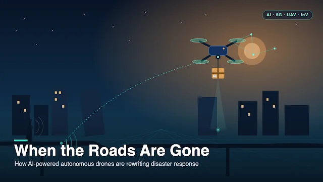
When a major earthquake strikes, the first problem is rarely a shortage of supplies — it is the inability to move them. Collapsed bridges, blocked roads, and downed communication towers can cut off entire communities in minutes, precisely when medical aid, clean water, and rescue teams are needed most.
On this page
- First, what “autonomous” actually means
- Why conventional disaster logistics falls short
- The technology stack
- What the real world already shows
- The hard problems that remain
- Where this is heading
- Why the stack, not the gadget: resilience through redundancy
- The bottom line
- Frequently asked questions
- References
When a major earthquake strikes, the first problem is rarely a shortage of supplies — it is the inability to move them. Collapsed bridges, blocked roads, and downed communication towers can cut off entire communities in minutes, precisely when medical aid, clean water, and rescue teams are needed most.
For decades, disaster logistics has leaned on trucks, helicopters, and manually coordinated operations. These remain indispensable, but they share a fatal weakness: they depend on the very infrastructure that disasters destroy (Van Wassenhove, 2006).
Autonomous drones are quietly rewriting that equation. By flying over damaged terrain, reaching isolated areas in minutes, and delivering both data and cargo without exposing responders to danger, unmanned aerial vehicles (UAVs) have moved from experimental gadgets to operational tools in real emergencies (Restas, 2015; Rejeb et al., 2021). But here is the part most coverage misses: the revolution is not the aircraft. It is the stack of digital technologies now flying inside it. A drone is only as useful as the intelligence that guides it, the network that connects it, and the systems that trust and act on what it sees.
This article unpacks that full stack — artificial intelligence, 5G, blockchain, the Internet of Vehicles (IoV), and digital twins — then tests each claim against what has actually happened in disasters from Türkiye to Rwanda, and closes with the hard, unglamorous problems that will decide whether any of it scales.
First, what “autonomous” actually means
Autonomy is a spectrum, not a switch.
Getting this wrong distorts the whole conversation. Most disaster drones today operate between remote piloting and full autonomy. They can hold a flight path, avoid obstacles, and analyze imagery on their own, while humans still set the objectives and approve consequential actions. That balance is deliberate, not a limitation. In emergencies the goal is never to remove people from the loop; it is to let software absorb the parts humans do poorly — speed, repetition, and scale — so that human judgment is freed for the decisions that carry ethical and life-or-death weight (Amershi et al., 2019).
This framing matters for everything that follows. Each technology below is best understood as an amplifier of human responders, not a replacement for them. When we later discuss AI “making decisions,” what we really mean is AI generating options, estimates, and warnings fast enough to be useful, with a person retaining authority over the call. Keep that distinction in mind; it is the difference between a tool that earns trust and one that quietly erodes it.
Why conventional disaster logistics falls short
Humanitarian logistics is not commercial logistics wearing a hi-vis vest. A retail supply chain is optimized over years for cost efficiency and reasonably predictable demand. A disaster supply chain must be assembled in hours, scale explosively, and then adapt continuously as the situation changes underneath it — what one influential study memorably described as operating “in high gear” (Van Wassenhove, 2006). Decades of operations research have documented why this is so unforgiving: incomplete information, priorities that shift by the hour, damaged infrastructure, and high-stakes trade-offs that classical optimization models struggle to represent (Altay & Green, 2006; Kovács & Spens, 2007). More recent reviews confirm that technology adoption — UAVs, AI, and shared data platforms — has become a central research theme precisely because the old methods leave too much on the table (Özdamar & Ertem, 2015; Altay et al., 2023).
It also helps to remember that disaster management is a cycle, not a single event: mitigation and preparedness before, response during, and recovery long after. Each phase has different information needs, and conventional logistics tends to be weakest in the moments that matter most — the chaotic first hours of response.
Across every major emergency, the same four structural weaknesses recur:
- Infrastructure dependence. Ground transport needs the roads, bridges, and terminals that disasters routinely destroy. When they fail, whole regions go dark exactly when supplies are most needed.
- Slow situational awareness. Traditional damage assessment relies on ground surveys and manned flights — slow, expensive, and dangerous in unstable terrain.
- Limited last-mile reach. In humanitarian logistics the “last mile” is a term of art — the final, hardest leg that moves relief from a regional hub to the people who actually need it (Van Wassenhove, 2006). Even when supplies reach the hub, getting them across a landslide, a flooded valley, or a collapsed district remains a stubborn bottleneck.
- Human risk. Sending responders into unstable buildings, contaminated zones, or unmapped terrain puts lives at risk during assessment and delivery (Erdelj et al., 2017).
Drones attack all four at once. Operating in three-dimensional airspace, they bypass broken ground infrastructure; deployable in minutes, they compress situational awareness from hours to near real time; and they reach places people cannot — safely. A systematic scoping review of drones in disaster management catalogues exactly these roles across mapping, search and rescue, and transport, while honestly flagging the operational gaps that still limit routine use (Syed Mohd Daud et al., 2022).
The technology stack
The individual capabilities of a drone are impressive. What makes them transformative is how the underlying technologies combine. Here they are, one layer at a time — but first, a reality check no software can override.
First, the physics: the payload–range–endurance triangle
Every design trades off three things that cannot all be maximized at once: payload (how much it carries), range (how far it flies), and endurance (how long it stays aloft) — all capped by a finite battery.
Before any algorithm runs, a drone is bound by physics. Push one corner of the triangle and another gives way. Add weather and the envelope shrinks further: most small UAVs cannot fly safely in high wind, heavy rain, or icing — a constraint that proved decisive in Nepal’s mountainous, weather-exposed terrain (Syed Mohd Daud et al., 2022). Even the routing algorithms for delivery drones are, at their core, attempts to optimize within this triangle under hard energy limits (Dorling et al., 2017).
This is exactly why airframe choice is not cosmetic. Multirotor drones hover and inspect with precision but drain batteries fast and travel short distances. Fixed-wing aircraft fly far and efficiently — which is precisely why Zipline chose them for long-range blood-and-vaccine delivery — but cannot hover or land vertically. Hybrid VTOL designs, like Wingcopter’s, split the difference: vertical takeoff without a runway, then efficient forward flight for range (Rejeb et al., 2021). Keep this triangle in mind through everything below; every “smart” capability ultimately runs on a battery with a hard ceiling.
AI: turning aircraft into decision-makers
The defining shift in modern UAVs is the move from remote control to autonomy, and artificial intelligence is the engine driving it. Three capabilities matter.
Perception. A disaster environment is chaotic and fast-changing, and the first job of an autonomous drone is simply to understand what it is looking at. Computer vision, thermal imaging, and LiDAR let UAVs detect survivors, classify structural damage, identify blocked roads, and map flood boundaries. This capability rests on a mature body of work in UAV photogrammetry and remote sensing (Nex & Remondino, 2014; Zhu et al., 2017), and reviews of earthquake-induced damage detection confirm the reliability of these methods across optical, radar (SAR), and LiDAR data (Dong & Shan, 2013; Ghaffarian et al., 2018). The practical payoff is speed: raw imagery becomes actionable operational intelligence in seconds rather than the days a ground survey would take.
Navigation. Disaster zones are precisely where GPS may be degraded, maps outdated, and new obstacles appear without warning. AI lets a drone plan routes dynamically, avoid freshly formed hazards, and re-plan mid-mission under real constraints — limited battery, changing priorities, multiple delivery points. This is a well-studied problem: researchers have formalized drone-specific vehicle routing that balances payload, energy, and time (Dorling et al., 2017). Autonomy is what lets a fleet operate at a tempo no human pilot roster could match.
Decision support. Beyond flying, AI increasingly helps decide — prioritizing which districts to survey, estimating delivery times across alternative routes, and flagging anomalies for human attention. The classic framing of AI as the design of rational agents that perceive their environment and act toward objectives maps almost perfectly onto autonomous logistics (Russell & Norvig, 2021), and comprehensive reviews trace this arc across the entire disaster cycle, from hazard prediction to logistics optimization (Sun et al., 2020).
But autonomy imports new risks. Machine-learning models inherit the biases of their training data. A damage-assessment model trained mostly on reinforced-concrete buildings can quietly fail in a region of masonry construction; a flood model tuned to temperate climates may misfire in the tropics (Mehrabi et al., 2021). And in life-critical settings, a black box is unacceptable — responders need to know why a model recommended a route or flagged a bridge as unsafe. This is why explainable AI has become central to operational trust, not a nice-to-have (Barredo Arrieta et al., 2020). The recurring principle: AI recommends, humans decide.
5G: the nervous system
Here is an uncomfortable truth. A drone that perfectly identifies survivors or computes an optimal route contributes almost nothing if that information cannot reach coordinators in time. Intelligence without communication is isolated intelligence. This is why 5G belongs in any serious discussion of drone logistics — not as “faster internet,” but as the communication backbone of autonomous operations (Fotouhi et al., 2019).
The single most relevant feature is Ultra-Reliable Low-Latency Communication (URLLC), engineered for mission-critical applications where delay or packet loss carries real consequences. For a UAV fleet, URLLC enables near real-time exchange of navigation commands, sensor feeds, collision-avoidance messages, and emergency alerts among drones, ground stations, and operations centres (Dahlman et al., 2021). This matters most for Beyond Visual Line of Sight (BVLOS) flights over damaged cities, where a link that drops for even a few seconds can interrupt autonomous navigation or command-and-control at the worst possible moment. Mobility compounds the challenge: unlike a car, a drone constantly changes altitude and position, crossing between cell towers within a single mission, which makes seamless “handover” between cells a live research problem.
There is a cruel irony built into all of this — call it the connectivity paradox: disasters tend to destroy terrestrial cellular infrastructure exactly when communication demand peaks. This is not hypothetical. When Hurricane Maria struck Puerto Rico, 95.2% of cell sites were knocked out of service at the peak (Federal Communications Commission, 2017) — the case study below returns to what that meant on the ground. That is why the field increasingly designs hybrid architectures — terrestrial 5G plus satellite links, portable base stations, and even airborne relay drones — so that connectivity survives when part of the network does not (Hayat et al., 2016). In this light, 5G is less a gadget and more the connective tissue that lets distributed intelligence behave like a single system.
Blockchain: a promising but still-unproven layer
Here the honest verdict matters more than the hype. Disaster response forces many organizations — governments, NGOs, hospitals, aviation authorities, private carriers — to exchange trusted information with no single authority in charge. In principle, blockchain offers a distributed trust layer for exactly this: tamper-resistant, independently verifiable records of authorizations, cargo custody, and delivery confirmations, plus “smart contracts” that automate routine steps (Kshetri, 2018). In practice, its role in humanitarian drone logistics remains largely theoretical — there is no scaled operational deployment to point to, and it adds computational and energy overhead that resource-constrained drones can ill afford, which is why the literature favors lightweight, permissioned designs over public blockchains (Saberi et al., 2019). Treat blockchain as a plausible future trust layer for multi-organization operations — worth watching, premature to rely on.
The Internet of Vehicles: connecting air and ground
Individually, these technologies are useful. Together, they become a system — and the Internet of Vehicles (IoV) is the integration layer that binds them. IoV connects drones with ambulances, emergency vehicles, traffic-management systems, connected warehouses, and command centres into one continuously communicating network (Erdelj et al., 2017). The drone stops being a lone aircraft and becomes one node in an adaptive transport ecosystem. This is also where multi-UAV coordination stops being futuristic: fleets already divide survey areas, relay one another’s signals, and reroute around obstacles with limited central control — a “swarm” capability sitting precisely at the intersection of edge AI and the rapid cell-to-cell handovers 5G was built for (Erdelj et al., 2017).
Consider a concrete scenario. A cardiac emergency occurs in a district cut off by a collapsed overpass. In an IoV-enabled system, a medical drone carrying a defibrillator is dispatched the instant the emergency call is logged, while an ambulance is simultaneously routed to the nearest reachable point. The drone reaches the patient in minutes; the ambulance meets responders where the road network still allows. Aerial and ground assets are not competing — they are coordinated in real time, each compensating for the other’s limits. This complementary model, rather than wholesale replacement of ground logistics, is exactly the pattern documented across humanitarian drone deployments (Rejeb et al., 2021). Making it work at scale depends on edge computing, which processes time-critical data close to the drone rather than shipping everything to a distant cloud and waiting (Zhou et al., 2019).
Digital twins: rehearsing the disaster before it happens
The most powerful integration of all is the digital twin — a continuously synchronized virtual model of a disaster environment that fuses satellite imagery, drone observations, weather forecasts, flood models, hospital capacities, shelter occupancy, and traffic data into one living picture (Grieves & Vickers, 2017; Tao et al., 2019). The distinction from a normal map is everything: a map shows what is; a digital twin shows what is, updates as conditions change, and — crucially — lets you simulate what would happen next.
That simulation capability turns logistics from reactive to predictive. Before committing an ambulance or a drone fleet, planners can ask the twin to compare options — ground transport versus a UAV fleet versus a helicopter relay — and see estimated delivery times side by side. When a bridge collapses in the model, the twin can predict the downstream consequences: which hospitals get isolated, how ambulance times change, and where drone delivery suddenly becomes the fastest route. Value accrues across the whole disaster cycle: simulating vulnerabilities during mitigation, rehearsing evacuations during preparedness, guiding decisions during response, and evaluating resilient reconstruction during recovery — an approach squarely aligned with the Sendai Framework’s emphasis on proactive, evidence-based risk governance (UNDRR, 2015).
Ambitious efforts such as the European Commission’s Destination Earth are building high-fidelity replicas of this kind (European Commission, n.d.) — but here honesty demands the same skepticism we applied to blockchain. Destination Earth is an Earth-system and climate twin, not an operational, drone-fed disaster-response twin. That latter system — city-scale, real-time, continuously updated from live UAV feeds and acting back on operations within minutes — remains largely aspirational today; the data-fusion and latency challenges are real and unsolved at scale. The concept is powerful; the operational reality is still mostly in the lab. The eventual frontier is the cognitive digital twin, which reasons and recommends while keeping a human firmly in command.
What the real world already shows
None of this is speculation. A decade of disasters has stress-tested these technologies — building on humanitarian UAV use documented since at least 2014 (OCHA, 2014; Greenwood & Joseph, 2020).
Key statistics from real-world deployments
95.2%
of Puerto Rico’s cell sites down at Hurricane Maria’s peak (FCC, 2017)
2M+
autonomous medical deliveries by Zipline as of early 2026
7,000+
volunteers mapping Nepal after the 2015 earthquake (HOT)
130,000 km
flown by Wingcopter’s medical-delivery program in Malawi
Türkiye earthquakes (2023). The twin earthquakes of 6 February 2023 triggered one of the largest response operations of the century. Satellite rapid-mapping delivered fast initial awareness — the Copernicus Emergency Management Service activated within hours (Copernicus EMS, 2023) — but satellite imagery alone proved too coarse for detailed urban damage assessment, and drones became essential for close inspection of collapsed buildings, bridges, and transport corridors. Reflecting on that response in our own analysis of the disaster, we found the defining bottleneck was coordination, not hardware: organizations operated largely in parallel, with limited interoperability and information-sharing that was far harder than it should have been (Teker, Bilgin, & Yildiz, 2026). International search-and-rescue is meant to be coordinated through the UN’s INSARAG framework, whose guidelines are only beginning to address how drones integrate into multi-team operations (INSARAG, 2020) — a gap the 2023 response laid bare. The devices performed; the connective tissue between organizations did not.
Nepal earthquake (2015). One of the first disasters where UAV mapping played a major humanitarian role. In mountainous terrain where landslides cut off villages, international and local groups mobilized more than 7,000 volunteers to combine satellite imagery, drone observations, and crowdsourced mapping into products that accelerated assessment and reconstruction — while exposing the need for legal frameworks agreed before disaster strikes (Humanitarian OpenStreetMap Team, n.d.).
Japan (2011) and Hurricane Maria (2017). Fukushima is often told as a robotics success story; the reality was more sobering. Japan’s own rescue robots were largely not field-ready in 2011, and initial reconnaissance inside the damaged reactor buildings relied on foreign systems such as the US-built iRobot PackBot — a shortfall that then catalyzed a decade of Japanese investment in disaster robotics (Nagatani et al., 2013). Hurricane Maria taught a different lesson: at its peak the storm knocked out 95.2% of Puerto Rico’s cell sites (Federal Communications Commission, 2017), underscoring that communication restoration is a prerequisite for effective logistics — with edge computing and airborne relays now seen as ways to build resilience for next time.
Zipline and Wingcopter. These operators prove the model at scale. Zipline pioneered national-scale medical drone delivery in Rwanda in 2016 — flying blood and vaccines to rural clinics — before expanding across Africa and into the United States; as of early 2026 it had logged more than two million autonomous commercial deliveries (Zipline, 2026). Wingcopter’s Malawi program, run with UNICEF and GIZ, delivered medical supplies across more than 130,000 flight kilometres serving a district of over 115,000 people (Wingcopter, n.d.). Their shared lesson: autonomy works best when woven into existing health systems, backed by standardized procedures and public trust — not bolted on as a novelty.
WFP, NASA, and Copernicus. The UN World Food Programme uses drones for mapping, cargo delivery, and flood assessment, explicitly treating them as a complement to conventional logistics rather than a substitute (World Food Programme, n.d.); practical norms for such deployments are consolidated in humanitarian drone field guides (FSD, 2016). Meanwhile, Earth-observation services from NASA’s Disasters Program and Copernicus EMS now supply operational damage, flood, and wildfire mapping that underpins response worldwide (NASA Applied Sciences, n.d.; Copernicus EMS, 2023).
Across every one of these cases, a humbling pattern holds: technology alone is never enough. Governance, interoperability, trained personnel, and public trust shaped outcomes at least as much as any device — and AI consistently performed best as decision support, accelerating human judgment rather than replacing it (Sun et al., 2020).
The hard problems that remain
Enthusiasm should not obscure the obstacles, and the most consequential ones are not about building a better aircraft.
- Regulation and airspace. Routine BVLOS flight is still restricted in many countries, and future disaster skies will be crowded — helicopters, crewed aircraft, and drone swarms sharing the same airspace. Safe integration requires mature Unmanned Traffic Management systems that international aviation bodies are still developing (ICAO, 2015). Cross-border humanitarian missions add further questions of sovereignty and spectrum.
- Cybersecurity. As logistics becomes autonomous, cyber risk stops being an IT problem and becomes an operational safety issue. GPS spoofing, communication jamming, or outright hijacking could send drones off course, into obstacles, or to the wrong destination. Risk-based, continuously monitored, “zero trust” security must be designed into these systems from the start, not patched on afterward (NIST, 2024).
- Privacy. Disaster response consumes enormous quantities of personal data — aerial imagery, medical records, phone locations, shelter registrations. That data saves lives, but it can also expose vulnerable people to surveillance and secondary harm. Data minimization, purpose limitation, and strong governance have to be built in from the design stage (ICRC, 2020).
- Bias, explainability, and human oversight. AI must perform fairly across regions, climates, and building types, and it must be transparent enough that responders can both trust and challenge its recommendations (Mehrabi et al., 2021; Barredo Arrieta et al., 2020). In a domain where errors cost lives, meaningful human oversight is non-negotiable.
- Interoperability and governance. Fragmented, incompatible systems remain a core barrier — the Türkiye response made that painfully clear. International standards and clear governance are essential, and they carry an equity dimension: the disaster-prone, lower-income countries that could benefit most are also the ones most likely to be left behind if access is uneven.
On the last point, the world’s major frameworks converge. From the Sendai Framework to the OECD, UNESCO, EU, and UN AI-governance initiatives, the consensus is that trustworthy systems require human oversight, transparency, accountability, and protection of fundamental rights (UNDRR, 2015; OECD, 2019; UNESCO, 2021; European Union, 2024; United Nations, 2024). Guidance aimed specifically at the disaster domain now covers both machine learning and its responsible use (GFDRR, 2018, 2021), and researchers increasingly frame adoption itself as a collaboration-and-trust problem rather than a purely technical one (Kuglitsch et al., 2022). Sector-specific norms already exist too, such as the Humanitarian UAV Code of Conduct’s practical guidance on data protection and community engagement (UAViators, 2020).
Where this is heading
The next decade of research is less about individual drones and more about integration and resilience. Expect progress on several fronts at once: swarms at scale, moving from the handful of coordinated drones possible today to hundreds operating safely over the same airspace; 6G and non-terrestrial networks that keep working when the ground network fails (Letaief et al., 2019; Saad et al., 2020); edge AI and federated learning that let models improve across organizations without centralizing sensitive data (Shi et al., 2016; Zhou et al., 2019); foundation models that reason jointly across imagery, text reports, and sensor feeds to summarize situations and surface options (Vaswani et al., 2017; Brown et al., 2020; Bommasani et al., 2021); and quantum optimization for the combinatorial routing and allocation problems that strain today’s solvers (Cerezo et al., 2021; Bharti et al., 2022).
Notice the common thread: the frontier problems are no longer about individual devices. They are about integration, resilience, trust, and oversight across complex socio-technical systems — keeping the machine on scale and speed while the human owns judgment (Amershi et al., 2019).
Why the stack, not the gadget: resilience through redundancy
Step back and the deeper logic emerges. Disasters do not fail one system at a time — they cascade. An earthquake collapses roads (breaking ground logistics), topples base stations (breaking connectivity), degrades GPS amid damaged structures (breaking navigation), and isolates a hospital (breaking the supply chain) — often within the same hour. No single technology survives that alone.
The real thesis beneath the buzzwords is resilience through redundancy: a system engineered so that the failure of one layer is absorbed by the others.
The case for the full stack is that each layer can cover another’s failure mode. If terrestrial 5G goes down, satellite links and airborne relays carry the traffic (Hayat et al., 2016). If GPS is spoofed or degraded, onboard computer vision keeps the drone oriented. If the cloud is unreachable, edge computing keeps time-critical decisions local (Zhou et al., 2019). If the roads are gone, the drone flies. The objective is not a single clever device but a system engineered so that the failure of one layer is absorbed by the others.
The bottom line
Disasters are becoming more frequent, more severe, and more expensive, and conventional logistics is often the first casualty. The answer is not any single breakthrough but the integration of several: AI to perceive and decide, 5G to communicate, blockchain as an emerging trust layer, the Internet of Vehicles to connect air and ground, and digital twins to simulate and predict. The evidence from Türkiye, Nepal, Puerto Rico, Rwanda, and beyond shows these technologies already work — provided they are woven into governed, interoperable, human-centered systems (Rejeb et al., 2021; Syed Mohd Daud et al., 2022).
So the real goal is not merely autonomous disaster logistics, but responsible autonomous disaster logistics: systems that pair computational intelligence with ethical governance, human oversight, cybersecurity, and transparency. Build it that way, and when the infrastructure fails and minutes matter, help can still reach the people who need it most.
Frequently asked questions
What is autonomous drone logistics in disaster response?
It is the use of AI-enabled unmanned aerial vehicles (UAVs) to move data and cargo during emergencies with minimal human piloting — mapping damage, inspecting infrastructure, and delivering medical supplies. The drones operate on a spectrum between remote control and full autonomy, handling flight and analysis themselves while humans set objectives and approve critical decisions.
Why can’t traditional logistics handle major disasters?
Conventional logistics depends on roads, bridges, and communication networks — the very infrastructure disasters destroy. It is also slow to gain situational awareness and struggles with the “last mile” to isolated communities. Drones bypass damaged ground infrastructure and compress assessment from hours to minutes (Van Wassenhove, 2006; Syed Mohd Daud et al., 2022).
What role does AI play, and does it replace human decision-makers?
AI gives drones perception (detecting damage and survivors), navigation (dynamic routing under battery and hazard constraints), and decision support (prioritizing tasks). It does not replace responders: across real deployments AI performs best as decision support, with humans retaining authority — “AI recommends, humans decide” (Sun et al., 2020; Barredo Arrieta et al., 2020).
Is blockchain actually used in humanitarian drone logistics?
Not yet at scale. Blockchain offers a plausible distributed trust layer for multi-organization coordination, but its role in humanitarian drone logistics remains largely theoretical, and it adds overhead that small drones can ill afford. It is worth watching, but premature to rely on (Kshetri, 2018; Saberi et al., 2019).
Where are drones already used for disaster response?
In the 2023 Türkiye earthquakes (damage assessment), the 2015 Nepal earthquake (crowdsourced mapping), and routine medical delivery by Zipline (Rwanda and beyond) and Wingcopter (Malawi). Much of the operational frontier has been in the Global South, where regulatory flexibility and infrastructure gaps created both the need and the room to experiment (Rejeb et al., 2021).
What is a digital twin in disaster management?
A digital twin is a continuously updated virtual model of a disaster environment that fuses satellite, drone, weather, and infrastructure data and lets planners simulate outcomes before acting. City-scale, drone-fed operational disaster twins are still largely aspirational, but the concept is powerful for turning logistics from reactive to predictive (Grieves & Vickers, 2017; UNDRR, 2015).
References
References
- Altay, N., & Green, W. G. (2006) OR/MS research in disaster operations management. European Journal of Operational Research, 175(1), 475–493.
- Altay, N., Heaslip, G., Kovács, G., Spens, K., Tatham, P., & Vaillancourt, A. (2023) Innovation in humanitarian logistics and supply chain management: A systematic review. Annals of Operations Research, 335(3), 965–987.
- Amershi, S., Weld, D., Vorvoreanu, M., et al. (2019) Guidelines for human-AI interaction. Proceedings of the 2019 CHI Conference on Human Factors in Computing Systems, 1–13.
- Barredo Arrieta, A., Díaz-Rodríguez, N., Del Ser, J., et al. (2020) Explainable Artificial Intelligence (XAI): Concepts, taxonomies, opportunities and challenges toward responsible AI. Information Fusion, 58, 82–115.
- Bharti, K., Cervera-Lierta, A., Kyaw, T. H., et al. (2022) Noisy intermediate-scale quantum algorithms. Reviews of Modern Physics, 94(1), 015004.
- Bommasani, R., Hudson, D. A., Adeli, E., et al. (2021) On the opportunities and risks of foundation models. arXiv.
- Brown, T. B., Mann, B., Ryder, N., et al. (2020) Language models are few-shot learners. Advances in Neural Information Processing Systems, 33, 1877–1901.
- Cerezo, M., Arrasmith, A., Babbush, R., et al. (2021) Variational quantum algorithms. Nature Reviews Physics, 3(9), 625–644.
- Copernicus Emergency Management Service (CEMS). (2023) EMSR648: Earthquake in East Anatolian Fault Zone, Türkiye [Rapid mapping activation]. European Commission.
- Dahlman, E., Parkvall, S., & Sköld, J. (2021) 5G NR: The next generation wireless access technology (2nd ed.). Academic Press.
- Dong, L., & Shan, J. (2013) A comprehensive review of earthquake-induced building damage detection with remote sensing techniques. ISPRS Journal of Photogrammetry and Remote Sensing, 84, 85–99.
- Dorling, K., Heinrichs, J., Messier, G. G., & Magierowski, S. (2017) Vehicle routing problems for drone delivery. IEEE Transactions on Systems, Man, and Cybernetics: Systems, 47(1), 70–85.
- Erdelj, M., Król, M., & Natalizio, E. (2017) Wireless sensor networks and multi-UAV systems for natural disaster management. Computer Networks, 124, 72–86.
- European Commission. (n.d.) Destination Earth (DestinE).
- European Union. (2024) Regulation (EU) 2024/1689 … (Artificial Intelligence Act). Official Journal of the European Union, L 2024/1689.
- Federal Communications Commission (FCC). (2017, September 21) Communications status report for areas impacted by Hurricane Maria.
- Fotouhi, A., Qiang, H., Ding, M., et al. (2019) Survey on UAV cellular communications: Practical aspects, standardization advancements, regulation, and security challenges. IEEE Communications Surveys & Tutorials, 21(4), 3417–3442.
- Ghaffarian, S., Kerle, N., & Filatova, T. (2018) Remote sensing-based proxies for urban disaster risk management and resilience: A review. Remote Sensing, 10(11), 1760.
- Global Facility for Disaster Reduction and Recovery (GFDRR). (2018) Machine learning for disaster risk management. World Bank.
- Global Facility for Disaster Reduction and Recovery (GFDRR). (2021) Responsible AI for disaster risk management. World Bank.
- Greenwood, F., & Joseph, D. (2020) Aid from the air: A review of drone use in the RCRC global network. American Red Cross.
- Grieves, M., & Vickers, J. (2017) Digital twin: Mitigating unpredictable, undesirable emergent behavior in complex systems. In Transdisciplinary Perspectives on Complex Systems (pp. 85–113). Springer.
- Hayat, S., Yanmaz, E., & Muzaffar, R. (2016) Survey on unmanned aerial vehicle networks for civil applications: A communications viewpoint. IEEE Communications Surveys & Tutorials, 18(4), 2624–2661.
- Humanitarian OpenStreetMap Team (HOT). (n.d.) Disaster activation: Nepal earthquake 2015.
- Humanitarian UAV Network (UAViators). (2020) Humanitarian UAV code of conduct & guidelines.
- International Civil Aviation Organization (ICAO). (2015) Manual on remotely piloted aircraft systems (RPAS) (Doc 10019 AN/507, 1st ed.). ICAO.
- International Committee of the Red Cross (ICRC). (2020) Handbook on data protection in humanitarian action (2nd ed.). ICRC & Brussels Privacy Hub.
- International Search and Rescue Advisory Group (INSARAG). (2020) INSARAG guidelines. UN OCHA.
- Kovács, G., & Spens, K. M. (2007) Humanitarian logistics in disaster relief operations. International Journal of Physical Distribution & Logistics Management, 37(2), 99–114.
- Kshetri, N. (2018) Blockchain’s roles in meeting key supply chain management objectives. International Journal of Information Management, 39, 80–89.
- Kuglitsch, M. M., Pelivan, I., Ceola, S., Menon, M., & Xoplaki, E. (2022) Facilitating adoption of AI in natural disaster management through collaboration. Nature Communications, 13, 1579.
- Letaief, K. B., Chen, W., Shi, Y., Zhang, J., & Zhang, Y.-J. A. (2019) The roadmap to 6G: AI empowered wireless networks. IEEE Communications Magazine, 57(8), 84–90.
- Mehrabi, N., Morstatter, F., Saxena, N., Lerman, K., & Galstyan, A. (2021) A survey on bias and fairness in machine learning. ACM Computing Surveys, 54(6), Article 115.
- Nagatani, K., Kiribayashi, S., Okada, Y., et al. (2013) Emergency response to the nuclear accident at the Fukushima Daiichi Nuclear Power Plants using mobile rescue robots. Journal of Field Robotics, 30(1), 44–63.
- NASA Applied Sciences. (n.d.) Disasters.
- National Institute of Standards and Technology (NIST). (2024) The NIST cybersecurity framework (CSF) 2.0 (NIST CSWP 29).
- Nex, F., & Remondino, F. (2014) UAV for 3D mapping applications: A review. Applied Geomatics, 6(1), 1–15.
- Organisation for Economic Co-operation and Development (OECD). (2019) Recommendation of the Council on Artificial Intelligence (OECD/LEGAL/0449).
- Özdamar, L., & Ertem, M. A. (2015) Models, solutions and enabling technologies in humanitarian logistics. European Journal of Operational Research, 244(1), 55–65.
- Rejeb, A., Rejeb, K., Simske, S., & Treiblmaier, H. (2021) Humanitarian drones: A review and research agenda. Internet of Things, 16, 100434.
- Restas, A. (2015) Drone applications for supporting disaster management. World Journal of Engineering and Technology, 3(3C), 316–321.
- Russell, S. J., & Norvig, P. (2021) Artificial intelligence: A modern approach (4th ed.). Pearson.
- Saad, W., Bennis, M., & Chen, M. (2020) A vision of 6G wireless systems. IEEE Network, 34(3), 134–142.
- Saberi, S., Kouhizadeh, M., Sarkis, J., & Shen, L. (2019) Blockchain technology and its relationships to sustainable supply chain management. International Journal of Production Research, 57(7), 2117–2135.
- Shi, W., Cao, J., Zhang, Q., Li, Y., & Xu, L. (2016) Edge computing: Vision and challenges. IEEE Internet of Things Journal, 3(5), 637–646.
- Sun, W., Bocchini, P., & Davison, B. D. (2020) Applications of artificial intelligence for disaster management. Natural Hazards, 103(3), 2631–2689.
- Swiss Foundation for Mine Action (FSD). (2016) Drones in humanitarian action: A guide to the use of airborne systems in humanitarian crises. FSD.
- Syed Mohd Daud, S. M. S., Mohd Yusof, M. Y. P., Heo, C. C., et al. (2022) Applications of drone in disaster management: A scoping review. Science & Justice, 62(1), 30–42.
- Tao, F., Zhang, H., Liu, A., & Nee, A. Y. C. (2019) Digital twin in industry: State-of-the-art. IEEE Transactions on Industrial Informatics, 15(4), 2405–2415.
- Teker, Y., Bilgin, R., & Yildiz, A. (2026) Reflecting on the 6 February 2023, Türkiye–Syria earthquake: Key lessons on disaster risk, response, and resilience. Journal of Risk Research, 29(1), 23–32.
- United Nations. (2024) Governing AI for humanity: Final report of the High-Level Advisory Body on Artificial Intelligence.
- UNESCO. (2021) Recommendation on the ethics of artificial intelligence.
- United Nations Office for Disaster Risk Reduction (UNDRR). (2015) Sendai framework for disaster risk reduction 2015–2030.
- United Nations Office for the Coordination of Humanitarian Affairs (OCHA). (2014) Unmanned aerial vehicles in humanitarian response (Occasional Policy Paper No. 010).
- Van Wassenhove, L. N. (2006) Humanitarian aid logistics: Supply chain management in high gear. Journal of the Operational Research Society, 57(5), 475–489.
- Vaswani, A., Shazeer, N., Parmar, N., et al. (2017) Attention is all you need. Advances in Neural Information Processing Systems, 30, 5998–6008.
- Wingcopter. (n.d.) Malawi on-demand medical delivery.
- World Food Programme (WFP). (n.d.) WFP drones.
- Zhou, Z., Chen, X., Li, E., Zeng, L., Luo, K., & Zhang, J. (2019) Edge intelligence: Paving the last mile of artificial intelligence with edge computing. Proceedings of the IEEE, 107(8), 1738–1762.
- Zhu, X. X., Tuia, D., Mou, L., et al. (2017) Deep learning in remote sensing: A comprehensive review and list of resources. IEEE Geoscience and Remote Sensing Magazine, 5(4), 8–36.
- Zipline. (2026) Zipline fact sheet. Retrieved February 12, 2026.
No comments yet. Be the first.